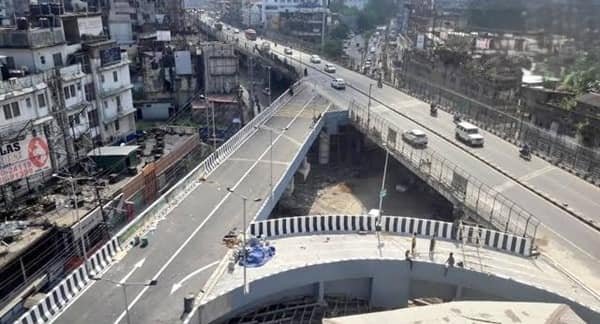
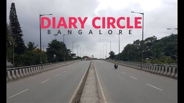
Dairy Circle Flyover is one of south-central Bengaluru’s long-standing grade-separated traffic landmarks. It sits in the Lakkasandra area on the busy Hosur Road corridor, close to NIMHANS, Christ University, Wilson Garden and routes leading towards Madiwala, Koramangala and Bannerghatta Road. The junction carries a mixture of city buses, private vehicles, institutional traffic and through movement on one of Bengaluru’s older arterial roads.
Dairy Circle is not a simple single flyover. The junction was developed as a multi-level traffic complex with an elevated flyover, surface roads and an underpass, so different traffic streams may use different levels. This layout reduces direct crossing conflicts at the circle, but queues can still form at the ends of the structure and at nearby signals, particularly near NIMHANS, Lakkasandra and the Christ University side.
| Particular | Details |
| Location | Dairy Circle / Lakkasandra, Bengaluru, Karnataka |
| Main Corridor | Hosur Road and adjoining M.H. Marigowda Road / Bannerghatta-side approaches |
| Junction Type | Multi-level grade-separated junction with flyover, surface road and underpass |
| Opened | The three-level complex became operational in 2004 |
| Key Connections | Madiwala, Koramangala, NIMHANS, Wilson Garden, Jayanagar and Bannerghatta Road side |
| Nearby Landmarks | NIMHANS, Christ University and Bengaluru Dairy area |
| Public Transport | Frequent BMTC bus services; direct Dairy Circle Metro station is still under construction |
| Traffic Pattern | Busy at college, hospital and office peaks; queues often form beyond the flyover ends |
Where Is Dairy Circle Flyover Located?
Dairy Circle Flyover is located in Lakkasandra in south-central Bengaluru, on the road axis linking the city centre and Lalbagh-NIMHANS side with Madiwala and the Hosur Road corridor. The circle is also an important access point for nearby institutional areas and for traffic moving towards Koramangala, Jayanagar and Bannerghatta Road.
The easiest way to identify the junction is by the cluster of well-known landmarks around it: NIMHANS lies to the north-west side of the wider corridor, Christ University is on the Hosur Road side, and the Dairy Circle bus stops serve several directions. Because the road passes through a dense urban area, local access lanes and bus stopping activity are as important to traffic flow as the elevated structure itself.
Connectivity of Dairy Circle Flyover
The flyover complex helps separate through traffic from local crossing movements. Vehicles using Hosur Road can move between the Madiwala/Koramangala side and the central Bengaluru side, while surface roads distribute traffic towards nearby neighbourhoods and institutions. The underpass provides another grade-separated movement through the junction.
Dairy Circle is particularly useful for people travelling between south-east Bengaluru and older central neighbourhoods. However, the capacity of the junction does not remove congestion at the next intersections. Traffic can still slow near NIMHANS, Christ University, Adugodi, Madiwala and local service-road entrances.
Directions to Dairy Circle Flyover
Because Dairy Circle has more than one traffic level, it is better to follow destination signs and lane markings than assume every vehicle should climb the flyover.
| Starting Point | Route / Direction |
| Madiwala / Koramangala Side | Approach on Hosur Road towards Dairy Circle and remain in the lane indicated for the central Bengaluru/NIMHANS side or your required local turn. |
| NIMHANS / Lalbagh Side | Travel towards Dairy Circle through the Lakkasandra-M.H. Marigowda Road corridor and choose the Hosur Road or local movement before the junction. |
| Bannerghatta Road Side | Use the connecting road network towards Dairy Circle and join the appropriate surface or grade-separated movement for Hosur Road. |
| Jayanagar / Wilson Garden | Approach through Wilson Garden/Lakkasandra connecting roads and follow signs for Dairy Circle, Madiwala or the city-centre side. |
| Adugodi Side | Use the local arterial road towards Dairy Circle and select the required movement for Hosur Road or the nearby institutional area. |
| Electronic City Direction | Join Hosur Road southbound via the Dairy Circle-Madiwala corridor and continue towards the elevated expressway approaches farther south if required. |
Do not rely only on the word “flyover” in navigation instructions. A route may deliberately keep you at ground level or send you through the underpass because that is the correct movement for your destination.
Nearby Areas Around Dairy Circle
Dairy Circle is surrounded by established residential, educational and medical districts, which explains the constant local traffic around the junction.
| Nearby Area | Why It Is Relevant |
| Lakkasandra | Immediate neighbourhood around Dairy Circle with residential and institutional activity. |
| NIMHANS / Hombegowda Nagar | Major medical and institutional area close to the north-west side of the junction. |
| Adugodi | Mixed residential and institutional locality towards the city-centre side of Hosur Road. |
| Koramangala | Large residential and commercial district reached through the Madiwala/Adugodi road network. |
| Madiwala | Busy transport and commercial area on Hosur Road south-east of Dairy Circle. |
| Wilson Garden | Established residential and commercial locality connected through Lakkasandra-side roads. |
| Jayanagar | Major south Bengaluru neighbourhood reachable through the Wilson Garden and local arterial network. |
| BTM Layout | Large residential area reached via the Madiwala and Bannerghatta Road side of the corridor. |
Short local trips can still be slow at school, hospital and office peaks. Pedestrian movement, buses stopping near the junction and queues at the next traffic signal can affect travel time even when the flyover itself is clear.
Public Transport and Metro Access
Dairy Circle is well served by BMTC buses, with stops around the junction for services towards the city centre, Jayanagar, Koramangala, Bannerghatta Road, Madiwala and other southern suburbs. Auto-rickshaws and cabs are common, but pickup and drop-off should be done on a safe local stretch rather than on the flyover approach.
A direct Dairy Circle Namma Metro station is being built as part of the underground section of the Pink Line. That underground section was not open to passengers in September 2026, so there is no direct operational Metro station at the circle yet. Travellers should use existing Metro stations only when they fit the rest of the trip and combine them with bus, auto or cab connections.
Driving Tips for Dairy Circle
• Read lane markings early because the flyover, underpass and surface roads serve different movements.
• Expect sudden bus stops and pedestrian activity near institutions and local bus bays.
• Keep extra following distance when descending from the flyover into a queue at the next junction.
• During rain, reduce speed on ramps and watch for water accumulation near lower-level roads.
• If navigation keeps you at ground level, do not climb the flyover simply because it looks faster; you may miss the required turn.
FAQs
Q. Why is Dairy Circle called a three-level or tri-level junction?
Traffic is separated vertically through an elevated flyover, surface-level roads and an underpass. The correct level depends on the direction in which a vehicle is travelling.
Q. Does the flyover remove traffic jams at Dairy Circle?
It removes some crossing conflicts, but congestion can still develop at the ends of the structure and at nearby junctions. Heavy bus, college and hospital traffic can also slow the approaches.
Q. Is the Dairy Circle Metro station open?
No direct Dairy Circle station was open to passengers in September 2026. The underground Pink Line station serving Dairy Circle is part of a section that is still under construction/commissioning.
Q. Which level should I use to reach a nearby institution such as NIMHANS or Christ University?
Use the route shown for the exact gate or destination. Local access may require the surface road rather than the flyover, so lane-level navigation is more reliable than choosing the elevated road automatically.
Q. Can pedestrians cross the main carriageway at Dairy Circle anywhere they want?
They should use designated crossings, skywalks or controlled pedestrian routes where provided. The roads around the junction carry fast and continuous traffic, making informal crossing risky.
Q. What should a driver do after entering the wrong level of the junction?
Continue safely to the next legal turning point. Reversing, stopping on a ramp or cutting across a divider near a grade-separated junction creates a serious collision risk.