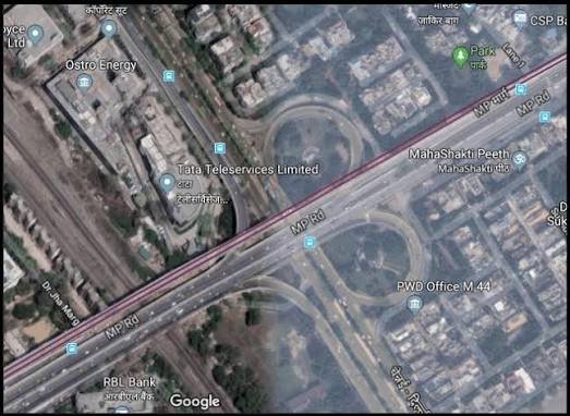
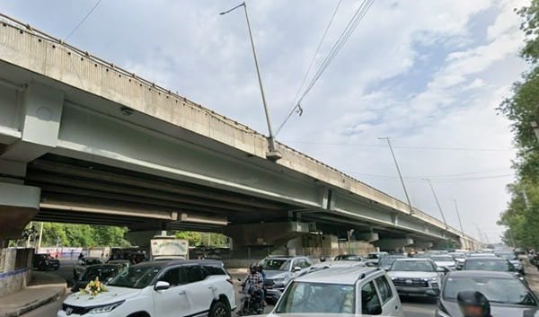
Porur is one of west Chennai’s most important junctions, linking Mount-Poonamallee Road with Arcot Road and routes toward Vadapalani, Guindy, Kundrathur, Poonamallee and Sriperumbudur. The Porur Flyover was built to move through traffic above this heavily used intersection and reduce the long delays that once dominated the junction.
The four-lane structure opened in June 2017 and was named the Bharat Ratna Puratchi Thalaivar Dr. MGR Flyover. It is about 505 metres long and roughly 17.3 metres wide. Today, the junction remains strategically important, but Chennai Metro Phase II construction in the Porur area means drivers should still check current traffic diversions before assuming the surface roads are unchanged.
Porur Flyover Quick Overview
| Particular | Details |
| Location | Porur Junction, Chennai, Tamil Nadu |
| Official Name | Bharat Ratna Puratchi Thalaivar Dr. MGR Flyover |
| Main Corridor | Mount-Poonamallee Road / Arcot Road junction |
| Length | About 505 metres |
| Width | About 17.3 metres |
| Lanes | Four lanes |
| Opened | 25 June 2017 |
| Current Context | Metro Phase II works can affect service-road movements |
Where Is Porur Flyover Located?
The flyover stands at Porur junction in western Chennai, where Mount-Poonamallee Road meets the Arcot Road/Kundrathur-side traffic system. The area has grown rapidly because of hospitals, IT offices, residential projects and improved access towards Poonamallee and the Chennai Bypass.
Connectivity of Porur Flyover
The flyover supports through movement between the Guindy/Ramapuram side and Poonamallee/Sriperumbudur direction. Surface roads handle local turns toward Arcot Road, Valasaravakkam, Kundrathur and neighbourhood streets. Porur is also part of Chennai Metro Phase II development, so road and future rail connectivity are increasingly integrated.
Directions to Porur Flyover
The most useful approach depends on where the trip starts and whether the driver needs the elevated through route or a local surface-road turn.
| Starting Point | Route / Direction |
| Guindy / Ramapuram Side | Follow Mount-Poonamallee Road west towards Porur and use the flyover for through movement toward Poonamallee when permitted. |
| Poonamallee Side | Travel east towards Porur and select the flyover lane for through movement toward Guindy/Ramapuram. |
| Vadapalani / Arcot Road Side | Approach Porur through Arcot Road and use the surface junction to join the required direction. |
| Kundrathur Side | Use Kundrathur Main Road toward Porur; local traffic diversions may guide vehicles around Metro work zones. |
| Chennai Bypass Side | Exit toward Porur and join the local arterial network; live navigation is advisable during Metro construction. |
Live navigation is recommended during peak periods because temporary traffic controls, road works, incidents or local diversions can change the fastest approach.
Nearby Areas Around Porur Flyover
The flyover serves more than one neighbourhood. These are the main nearby areas and why they matter to commuters.
| Nearby Area | Why It Is Relevant |
| Ramapuram | Major residential-commercial area east of Porur on Mount-Poonamallee Road. |
| Valasaravakkam | Dense residential locality connected through Arcot Road. |
| Iyyappanthangal | Rapidly developing area west of Porur towards Poonamallee. |
| Kattupakkam | Residential-commercial suburb farther west. |
| Kundrathur | Important southwest suburban destination connected by Kundrathur Main Road. |
| Poonamallee | Major western transport and suburban hub. |
| Manapakkam | Office and residential area towards Guindy. |
| Sri Ramachandra Medical Area | Major hospital/education landmark close to Porur. |
Why Porur Flyover Matters for West Chennai
Porur has become a major employment, medical and residential hub, and Mount-Poonamallee Road is a critical route between the western suburbs and Guindy-side business districts. The flyover removed one important signal-level conflict, but the junction continues to handle turning traffic from Arcot Road and Kundrathur Road. Metro Phase II construction adds another layer to traffic management, making Porur a constantly evolving interchange.
Route Planning Notes
Drivers should distinguish between the through flyover and the local service-road system. A vehicle heading from Guindy towards Poonamallee may benefit from the elevated route, while a trip to Valasaravakkam, Kundrathur or a nearby hospital may require staying below. Temporary Metro diversions can alter these movements, so current signs should take priority over older route habits.
Public Transport and Local Access
MTC buses, autos and cabs are currently the main public-transport options at Porur. Chennai Metro Phase II is under construction through the area, and traffic diversions have periodically changed service-road access around the flyover. Travellers should verify whether the specific Metro station they intend to use is operational before relying on it.
Driving Tips
- Check current Metro construction diversions before travelling through Porur.
- Use surface roads for Arcot Road, Kundrathur and immediate local destinations.
- Stay alert for buses entering and leaving stops near the junction.
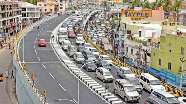
- During office peaks, queues can form at the ends of the flyover even if the deck itself is moving.
- Do not stop on the flyover for pickups.
FAQs
1. What is the official name of Porur Flyover?
It was named the Bharat Ratna Puratchi Thalaivar Dr. MGR Flyover when opened in 2017.
2. Is Porur Metro Station already operating?
Metro Phase II construction is underway in the Porur corridor. Passengers should check the latest Chennai Metro operating map before planning a Metro journey.
3. Why are traffic routes around Porur sometimes different from older maps?
Metro construction has required temporary service-road closures and diversions, so turn movements can change.
4. Which traffic benefits most from the flyover?
Through traffic along the Mount-Poonamallee Road corridor toward Guindy/Ramapuram or Poonamallee benefits most.
5. Should vehicles going to Arcot Road stay on the flyover?
Usually local turns toward Arcot Road require the surface junction. Follow signage and live navigation.
6. Is the flyover enough to prevent peak-hour congestion?
No. Porur remains a major multi-road junction, and congestion can still build at ramps, service roads and construction zones.