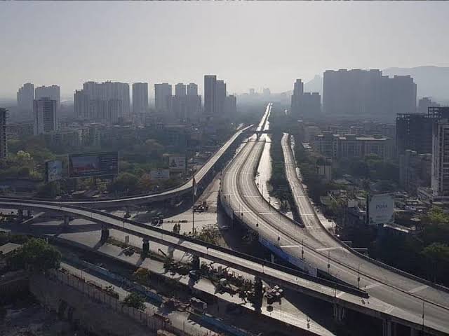
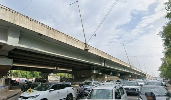
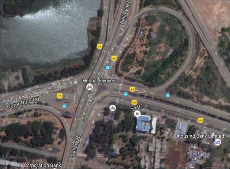
Hebbal Flyover is one of North Bengaluru’s most recognisable transport landmarks and the main road gateway between the city and Kempegowda International Airport. Built around the meeting point of Bellary Road/NH-44 and the Outer Ring Road, the interchange carries airport traffic, cross-city ORR traffic, buses, commercial vehicles and local trips for Hebbal, Nagawara, RT Nagar and Yelahanka. Hebbal Lake beside the junction makes the location easy to recognise, but the road layout itself is complex enough that first-time drivers should pay close attention to lane signs.
This is not a simple straight flyover. Hebbal functions as a multi-ramp grade-separated interchange, and its layout has been expanded over time to handle much higher traffic than the original junction was designed for. New loop capacity and resurfacing works have improved some movements, yet the wider approach can still become congested, particularly where airport-bound traffic, city-bound traffic and Outer Ring Road streams merge. The future Blue Line metro is also being built through the Hebbal area, but Hebbal station remains under construction as of September 2026.
Hebbal Flyover Quick Overview
| Particular | Details |
| Location | Hebbal, North Bengaluru, Karnataka |
| Main Corridor | Bellary Road / NH-44 |
| Major Cross Corridor | Outer Ring Road |
| Interchange Type | Multi-ramp / partial cloverleaf grade-separated junction |
| Key Landmark | Hebbal Lake |
| Airport Role | Primary road gateway between central Bengaluru and Kempegowda International Airport |
| Metro Status | Hebbal Blue Line station is under construction; no operational metro station at the flyover yet |
Where Is Hebbal Flyover Located?
Hebbal Flyover is located north of Bengaluru’s central business districts at the point where Bellary Road crosses the Outer Ring Road. The junction also sits close to Hebbal railway station, Hebbal Lake and the road approaches for Nagawara, Yelahanka and northern residential areas.
The flyover system carries Bellary Road through traffic above the junction while ramps and at-grade roads distribute vehicles towards different ORR and local-road directions. Because several movements overlap in a limited space, the correct ramp can depend not only on destination but also on which side of the junction you approach from.
Connectivity of Hebbal Flyover
For airport travel, Hebbal is the most important northern gateway from central Bengaluru. NH-44 continues from the junction towards Yelahanka, Devanahalli and the airport. Southbound, Bellary Road leads towards Mekhri Circle and the city centre.
The Outer Ring Road provides cross-city connectivity towards Nagawara, Hennur and KR Puram on the eastern side and towards BEL, Yeshwanthpur and Tumakuru Road on the western side. This combination makes Hebbal valuable even for trips that do not involve the airport.
Directions to Hebbal Flyover
The table below gives the most practical approach from major surrounding corridors. Exact lane choice can change with traffic management, so road signs and live navigation should take priority.
| Starting Point | Route / Direction |
| Kempegowda International Airport | Follow NH-44/Bellary Road south towards Bengaluru and select the appropriate Hebbal ramp for the city centre or Outer Ring Road. |
| Mekhri Circle / City Centre | Travel north on Bellary Road. Stay with the signed airport movement for NH-44 or take the required ORR ramp before the interchange. |
| Nagawara / KR Puram Side | Approach on Outer Ring Road from the east and follow signs for Bellary Road, airport or city-bound traffic. |
| Yeshwanthpur / BEL Side | Use Outer Ring Road towards Hebbal and choose the signed ramp for the airport, city centre or local Hebbal roads. |
| Yelahanka | Use Bellary Road/NH-44 south towards Hebbal; remain on the main corridor for central Bengaluru or take the relevant ORR exit. |
| Manyata Tech Park | Use the Nagawara/ORR approach. Peak-hour travel time can vary sharply, so live navigation is recommended. |
Nearby Areas Around Hebbal Flyover
These are the main neighbourhoods and activity areas commonly associated with the junction and its approach roads.
| Nearby Area | Why It Is Relevant |
| Hebbal | Established north Bengaluru neighbourhood surrounding the interchange. |
| Hebbal Kempapura | Residential and commercial area north-west of the junction. |
| Nagawara | Major ORR locality east of Hebbal and an approach for Manyata Tech Park. |
| RT Nagar | Dense residential area south-east of Hebbal with city-side road access. |
| Sahakara Nagar | Residential locality north-west of Hebbal on the airport-road side. |
| Yelahanka | Major northern suburb further along NH-44 towards the airport. |
| Manyata Tech Park | Large employment hub reached mainly through the Nagawara/ORR side. |
| Hebbal Lake | Prominent lake and visual landmark beside the interchange. |
Public Transport and Metro Access
BMTC buses and airport-oriented Vayu Vajra services make Hebbal an important transfer point for road-based public transport. Bus stops around the wider junction serve routes to the airport, city centre and several parts of Bengaluru, although the correct stop may be on a different side of the interchange depending on direction.
A Namma Metro Blue Line station is being built in the Hebbal area as part of the airport corridor, but it is not yet an operational metro option as of September 2026. Until that opens, buses, cabs and autos remain the main public-transport choices at the flyover.
Driving Tips for Hebbal Flyover
For airport trips, keep a time buffer even if the main flyover is moving because approach roads can still queue.
Read ramp signs early; a wrong loop can add a substantial detour around the interchange.
Do not stop on loop ramps to check directions or pick up passengers.
Expect changing lane patterns where metro and road improvement work is active.
Use extra caution in rain because curved ramps and merging traffic reduce stopping distance.
FAQs
Q. 1. Is Hebbal Flyover the main road route to Bengaluru airport?
Yes. Bellary Road/NH-44 through Hebbal is the principal city-to-airport road corridor, although the best approach to Hebbal itself depends on where your trip starts.
Q. 2. Is Hebbal Metro Station operational now?
No. The Blue Line station at Hebbal is still under construction as of September 2026. Road-based public transport remains the practical option at the junction.
Q. 3. Why is Hebbal confusing for first-time drivers?
Several ramps, loops, service roads and at-grade movements meet at one interchange. The airport, city centre and two directions of the Outer Ring Road require different lane choices.
Q. 4. Can I change from an airport bus to an ORR bus at Hebbal?
Hebbal is a major bus interchange area and such transfers are common, but stops are spread around the junction. Check the boarding side for your onward direction before crossing local roads.
Q. 5. Does the flyover remove all traffic congestion at Hebbal?
No. It separates major movements, but heavy demand at merges and downstream signals can still create long queues, especially during peak periods.
Q. 6. Is Hebbal Lake accessible directly from the flyover?
No. The flyover is a high-speed traffic structure. Any visit to the lake should be made through local access roads and designated pedestrian entry points, not from the flyover carriageway.