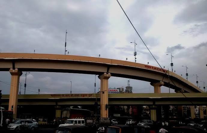
Sumanahalli Flyover is a major west Bengaluru grade separator on the Outer Ring Road, serving the busy crossing where the ring-road corridor meets roads around Sumanahalli and the Magadi Road side. It is especially important for traffic moving between the Mysuru Road and Tumakuru Road sections of the ORR, allowing through vehicles to avoid the surface junction while local traffic turns towards Kamakshipalya, Kottigepalya, Laggere and surrounding neighbourhoods.
The four-lane flyover was built in 2010 and is about 546 metres long. It has undergone significant repairs in the past, including attention to damaged deck portions, so motorists may occasionally encounter maintenance-related restrictions. In normal use, however, the key navigation issue is straightforward: use the elevated carriageway for ORR through movement and the surface roads for neighbourhood access or Magadi Road-side turns.
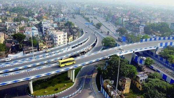
Sumanahalli Flyover Quick Overview
| Particular | Details |
| Location | Sumanahalli, West Bengaluru, Karnataka |
| Main Corridor | Outer Ring Road / Dr Puneeth Rajkumar Road |
| Road Role | Through movement between Mysuru Road and Tumakuru Road sides of the ORR |
| Flyover Type | Four-lane urban flyover |
| Approx. Length | About 546 metres |
| Key Local Connections | Kamakshipalya, Kottigepalya, Laggere, Nagarbhavi and Magadi Road side |
| Metro Access | No metro station at the flyover; road transfer is required to Purple Line stations farther inside the city |
Where Is Sumanahalli Flyover Located?
Sumanahalli Flyover lies on the western arc of Bengaluru’s Outer Ring Road. The junction is west of the central city and forms part of the important ORR link between the Mysuru Road corridor to the south and Tumakuru Road/Peenya corridor to the north.
Local roads below and around the flyover serve Sumanahalli, Kamakshipalya, Kottigepalya and Magadi Road-side neighbourhoods. This means many short local trips should remain at ground level instead of using the flyover.
Connectivity of Sumanahalli Flyover
Northbound ORR traffic can continue towards Laggere, Goraguntepalya and Tumakuru Road, while southbound movement connects towards Nagarbhavi, Mysuru Road and the south-western ORR. Local approaches lead towards Magadi Road and dense western neighbourhoods.
The flyover is particularly useful for cross-city traffic that does not need to enter Sumanahalli itself. Surface congestion can still build from buses, local commercial traffic and turning vehicles even when the elevated through lanes remain moving.
Directions to Sumanahalli Flyover
The table below gives the most practical approach from major surrounding corridors. Exact lane choice can change with traffic management, so road signs and live navigation should take priority.
| Starting Point | Route / Direction |
| Tumakuru Road / Peenya Side | Travel south on the Outer Ring Road towards Sumanahalli. Stay on the flyover for through movement or use surface lanes for local Sumanahalli/Magadi Road turns. |
| Mysuru Road / Nagarbhavi Side | Travel north on the ORR. Use the elevated through lane for Tumakuru Road side destinations and exit early for local neighbourhoods. |
| Magadi Road Side | Use the local connecting roads towards Sumanahalli junction and join the required ORR direction at surface level. |
| Kamakshipalya | Approach through local roads and remain on the surface carriageway for neighbourhood access. |
| Laggere | Use the ORR towards Sumanahalli and follow the north/south movement according to destination. |
| Nagarbhavi | Use the ORR north towards Sumanahalli for Tumakuru Road/Peenya movement or take local exits as required. |
Nearby Areas Around Sumanahalli Flyover
These are the main neighbourhoods and activity areas commonly associated with the junction and its approach roads.
| Nearby Area | Why It Is Relevant |
| Sumanahalli | Local residential and institutional area around the junction. |
| Kamakshipalya | Dense west Bengaluru locality close to the Magadi Road side. |
| Kottigepalya | Residential and commercial locality near the flyover approaches. |
| Laggere | Large residential area on the ORR towards the Tumakuru Road side. |
| Nagarbhavi | Major residential district south of Sumanahalli on the ORR corridor. |
| Vijayanagar | Established west Bengaluru neighbourhood reachable through inner-city roads. |
| Peenya / Goraguntepalya | Industrial and transport belt further north towards Tumakuru Road. |
Public Transport and Metro Access
BMTC buses are the main public-transport option around Sumanahalli and provide connections along the ORR and towards western residential areas. Autos and cabs are also widely available on local roads.
There is no Namma Metro station directly at the flyover. Passengers using the Purple Line generally need a road connection towards stations farther inside west Bengaluru, so the best transfer point depends on the origin and destination.
Driving Tips for Sumanahalli Flyover
Use the flyover mainly for ORR through movement; local Sumanahalli access is below it.
Follow any civic or traffic-police restrictions when maintenance work is announced.
Watch for buses and two-wheelers merging at the surface junction.
Avoid stopping on the flyover to inspect a route or vehicle problem unless it is an emergency.
Reduce speed in rain and after resurfacing or repair activity because lane edges and markings may change.
FAQs
Q. 1. What movement does Sumanahalli Flyover mainly serve?
It primarily carries Outer Ring Road through traffic, especially vehicles moving between the Mysuru Road and Tumakuru Road sides without needing local Sumanahalli turns.
Q. 2. Was the flyover repaired in the past?
Yes. The structure has had deck-damage incidents and repair work in earlier years. Motorists should follow current civic and traffic advisories if any maintenance restriction is announced.
Q. 3. Should I use the flyover to reach Kamakshipalya or Kottigepalya?
Usually surface roads are more useful for these local destinations. Staying on the flyover can carry you beyond the local turn.
Q. 4. Is there a metro station at Sumanahalli Flyover?
No. Metro travel requires a road transfer to a Purple Line station farther inside west Bengaluru.
Q. 5. Why can traffic queue below the flyover even if the top is clear?
The ground-level junction handles local turns, buses, commercial activity and neighbourhood access. Those movements are separate from the ORR through traffic carried above.
Q. 6. What should I do if maintenance closes a lane on the flyover?
Follow barricades and Bengaluru traffic advisories, merge early and avoid using local residential streets as an unsafe shortcut unless navigation directs traffic through an authorised route.